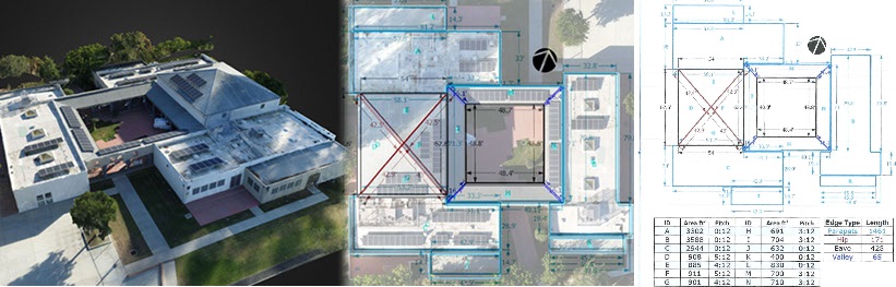
Whether you’re inspecting a new building or investigating an insurance claim, it’s important to capture accurate data quickly. Drone mapping is a powerful new tool allowing inspectors to safely and easily capture high-resolution aerial views of a site in minutes. This process simplifies inspections of non-accessible areas such as roofing, allowing the inspector to remain safely on the ground while reducing time spent in danger zones. Create detailed reports that include linear dimensions, area measurements and slope calculations, as well as create professional quality footage of your projects that you can use later in your marketing portfolio. Back in the office or out in the field, it’s easy to analyze high‐fidelity reconstructions of sites, take measurements, and share comments efficiently.