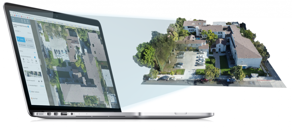
Technology has given us the ability to create detailed 3D imaging to provide accurate and efficient site or building measurements. 3D modeling creates a vivid display of your development site and provides a collaborative experience with clients and field personnel. There is no need to wait for a survey crew or use expensive LiDAR measuring devices to accurately measure progress on your site. Using a UAV, we can provide this information in a fraction of the time of a ground-based survey crew.
3D models can be most useful for inventory management, elevation measurements, high-resolution 2D maps (aka orthomosaics), marketing media, stockpile management as well as weekly or monthly progress monitoring. This allows teams to work efficiently and stay on schedule without stepping foot on the project site. Collaborate together visually, make annotations, and take measurements while keeping track of the progress. 3D models encourage innovative design by exhibiting the architectural panorama of a project’s structure and surrounding area.