Services
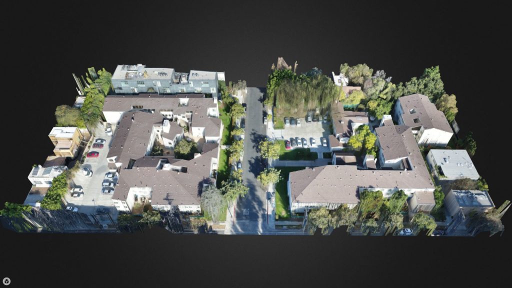
3D Modeling
Technology has given us the ability to create detailed 3D imaging to provide accurate and efficient site or building measurements. 3D modeling creates a vivid display of your development site and provides a collaborative experience with clients and field personnel. There is no need to wait for a survey crew or use expensive LiDAR measuring devices to accurately measure progress on your site. Using a UAV, we can provide this information in a fraction of the time of a ground-based survey crew.
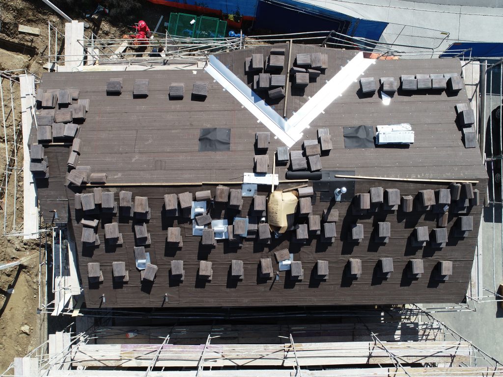
Aerial Inspections
In partnership with our affiliated partner, Pacific InterWest Building Consultants, Inc., Pacific States Aerial provides aerial imagery that allows for detailed inspections of the building envelope (below-grade, walls and roofing) that cannot be captured by ground based inspections. The drone allows for a detailed inspection to be performed without damaging the roof and placing the inspector in unsafe conditions.
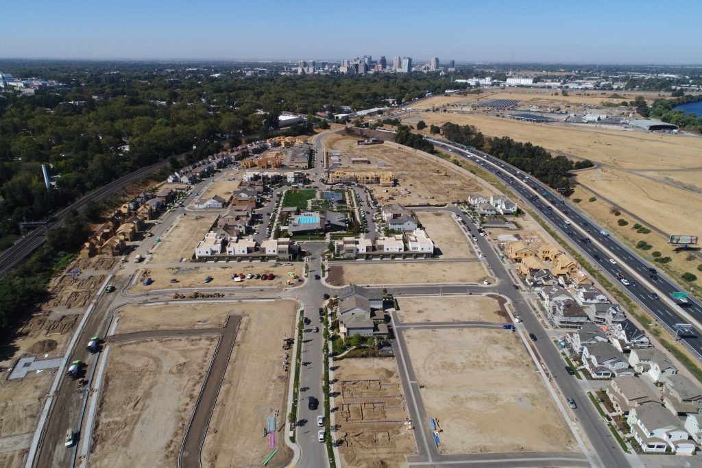
Aerial Mapping
Many projects are monitored and managed from a distance. Project managers, investors and executives normally visit the jobsite periodically. Aerial modeling and mapping offers time-lapsed imaging of your jobsite on a scheduled basis. Whether being used for draw requests, progress reporting, or as-built documentation, aerial mapping is the solution. Each visit to a site exported as a 3D model gives distant stakeholders a real view of the progress onsite. Export any of these models to a Point‐Cloud file and you can measure to ½ cm accuracy. Imagine a map of the post tension cables in the base of a large building that can be measured to ½ cm anytime in the future.
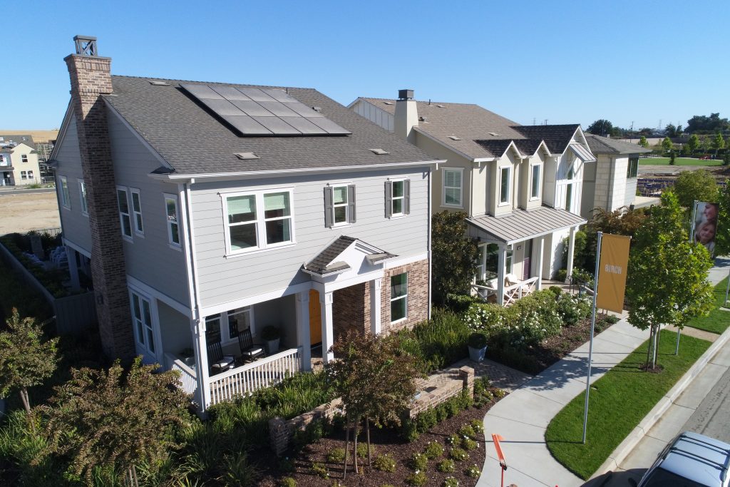
Marketing Photos & Videos
Many projects are monitored and managed from a distance. Project managers, investors and executives normally visit the jobsite periodically. Aerial modeling and mapping offers time-lapsed imaging of your jobsite on a scheduled basis. Whether being used for draw requests, progress reporting, or as-built documentation, aerial mapping is the solution. Each visit to a site exported as a 3D model gives distant stakeholders a real view of the progress onsite. Export any of these models to a Point‐Cloud file and you can measure to ½ cm accuracy. Imagine a map of the post tension cables in the base of a large building that can be measured to ½ cm anytime in the future.
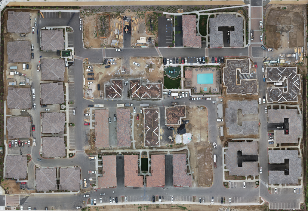
Orthomosaics
Orthomosaic maps are a grouping of overlapping images of a defined area which are processed to create a new, larger “orthomosaic”: a highly detailed, up-to-date map that is in true scale. The meta-information within an orthomosaic map allows for point clouds, volumetrics, NDVI, 3D tours and more. This opens up endless possibilities for your business by allowing clients to virtually tour your construction site via 2D or 3D maps for visual progress reporting, deliver up-to-date maps of your real estate to potential buyers, calculate raw materials on a construction site or easily conduct inspections over difficult terrain. Our team can deliver highly detailed, up-to-date maps of your property saving you time, money and manpower.
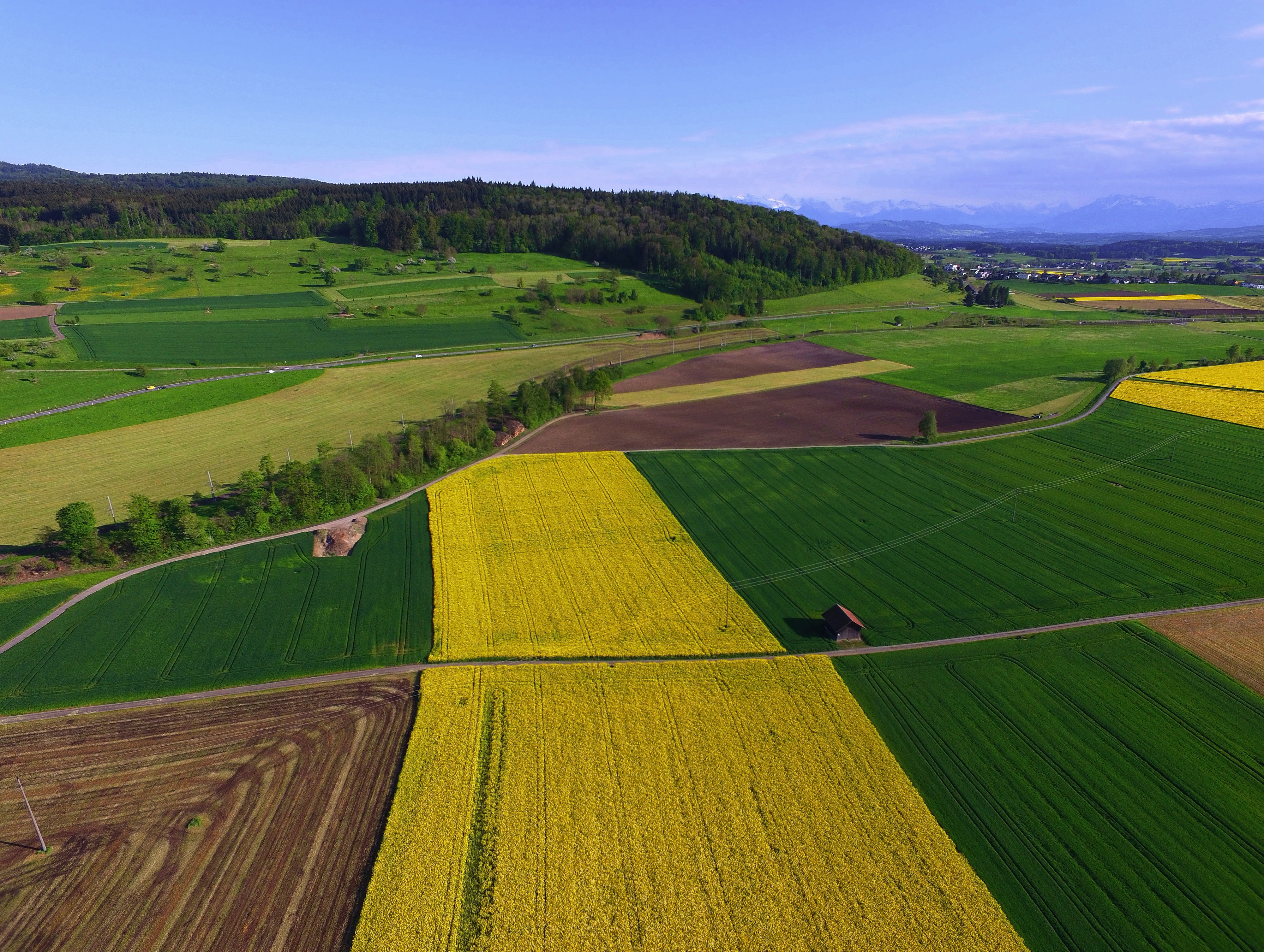
Plant Health
Agricultural drones allow relief for the modern-day farmer. Drone technology can cut down labor requirements and reduce resource requirements (such as fresh water and pesticides). Farmers are also able to use drones to retrieve aerial‐view images of their fields; there are currently three different types of view provided to the farmer through a drone. The first is seeing the crop from a bird’s-eye view; this view can reveal many issues such as irrigation problems, soil variation, and of course, pest and fungal infestations.
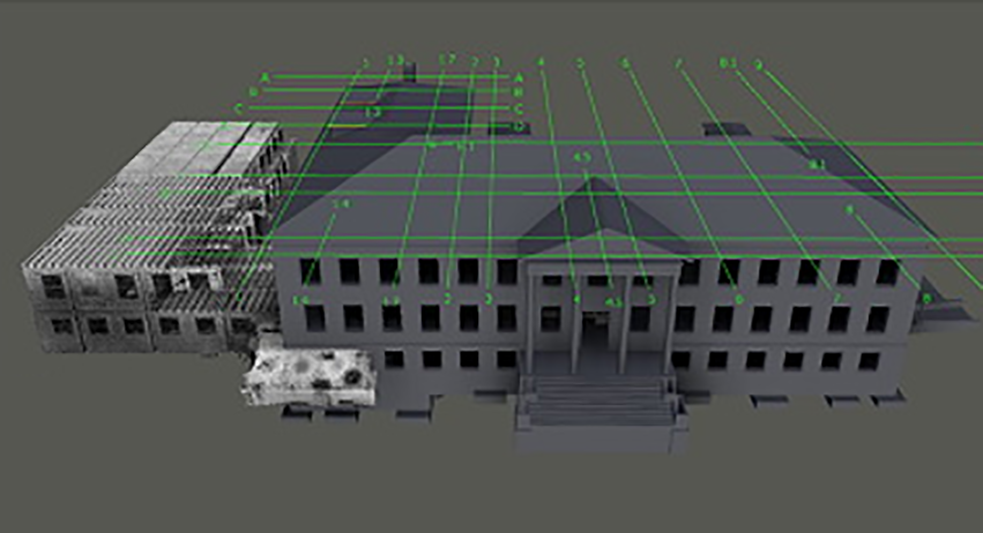
Point Cloud Exports
Virtual design and construction teams are quickly discovering the value that drone mapping brings to all stages of a construction project, including initial site survey and design, volume and elevation measurements and comparisons, and quality assurance. In a fraction of the time it takes to conduct a ground‐based survey, a drone can automatically fly and capture imagery of a project site that can then be processed into highly accurate point clouds compatible with Building Information Modeling (BIM) software.
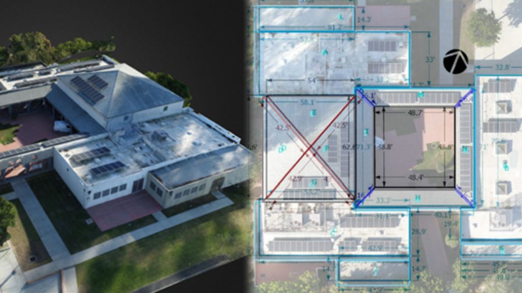
Site & Building Measurements
Virtual design and construction teams are quickly discovering the value that drone mapping brings to all stages of a construction project, including initial site survey and design, volume and elevation measurements and comparisons, and quality assurance. In a fraction of the time it takes to conduct a ground‐based survey, a drone can automatically fly and capture imagery of a project site that can then be processed into highly accurate point clouds compatible with Building Information Modeling (BIM) software.
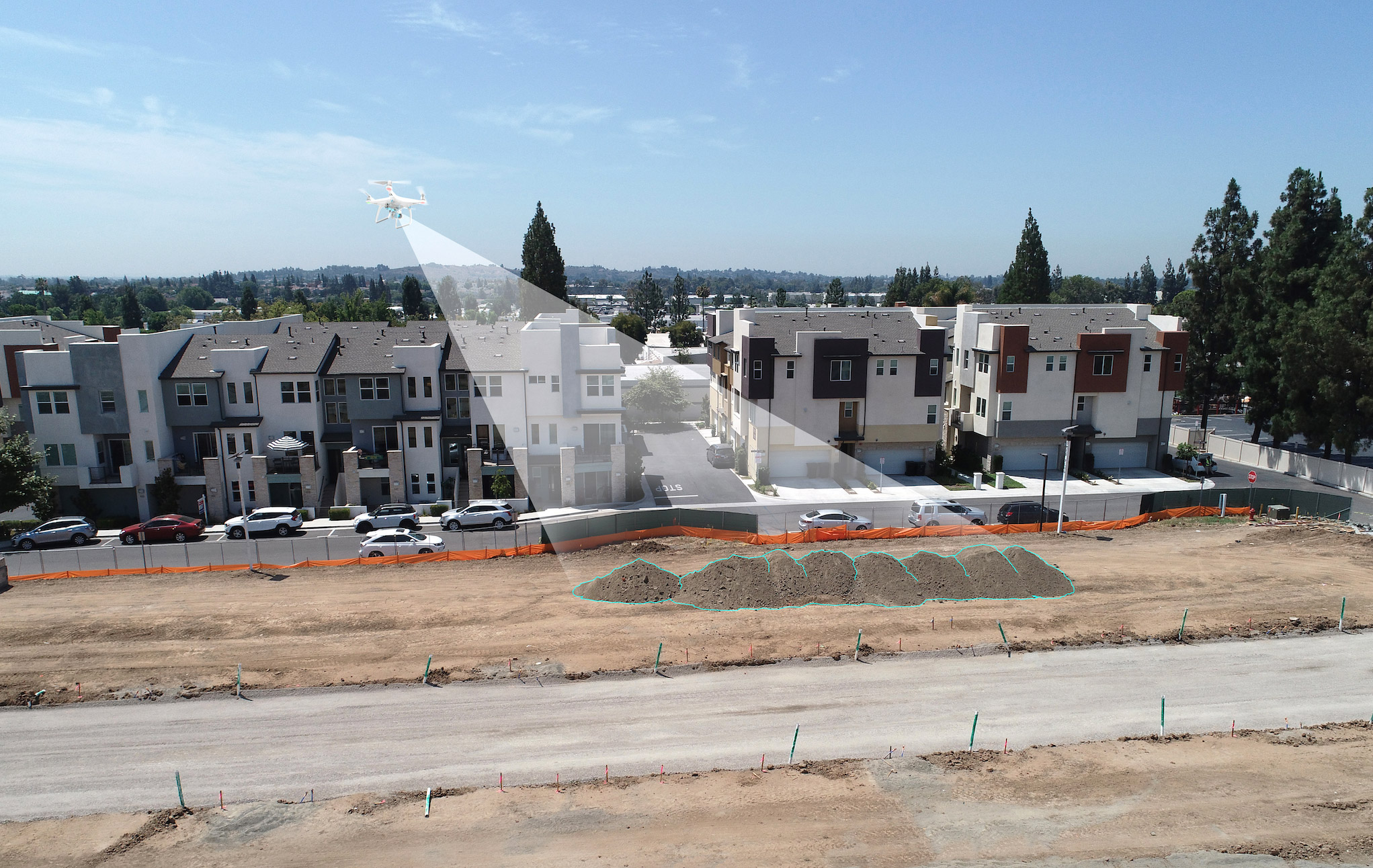
Volume Measurements
Aerial imagery provides accurate volume measurements during grading operations, for stockpile surveys, and even to estimate the amount of construction material delivered and available on‐site.